Day 25: Circle MT
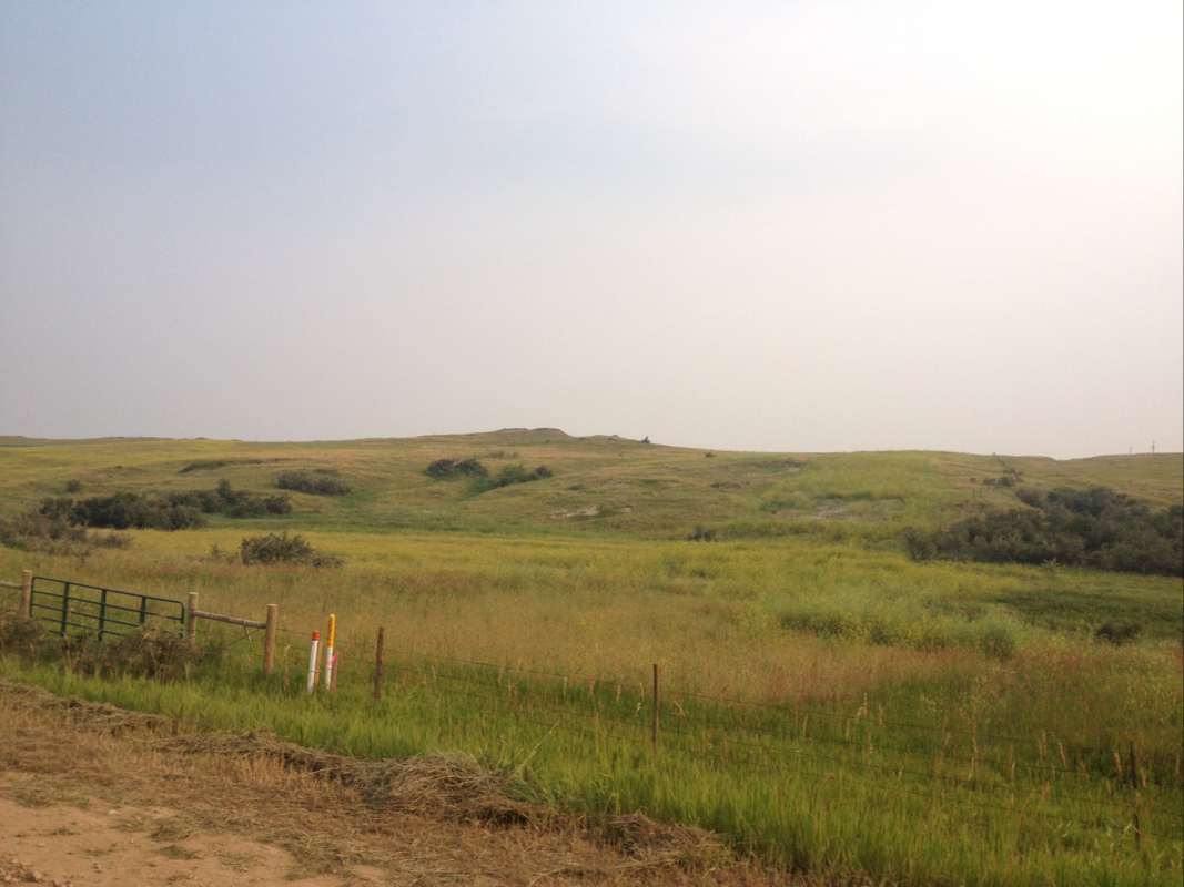
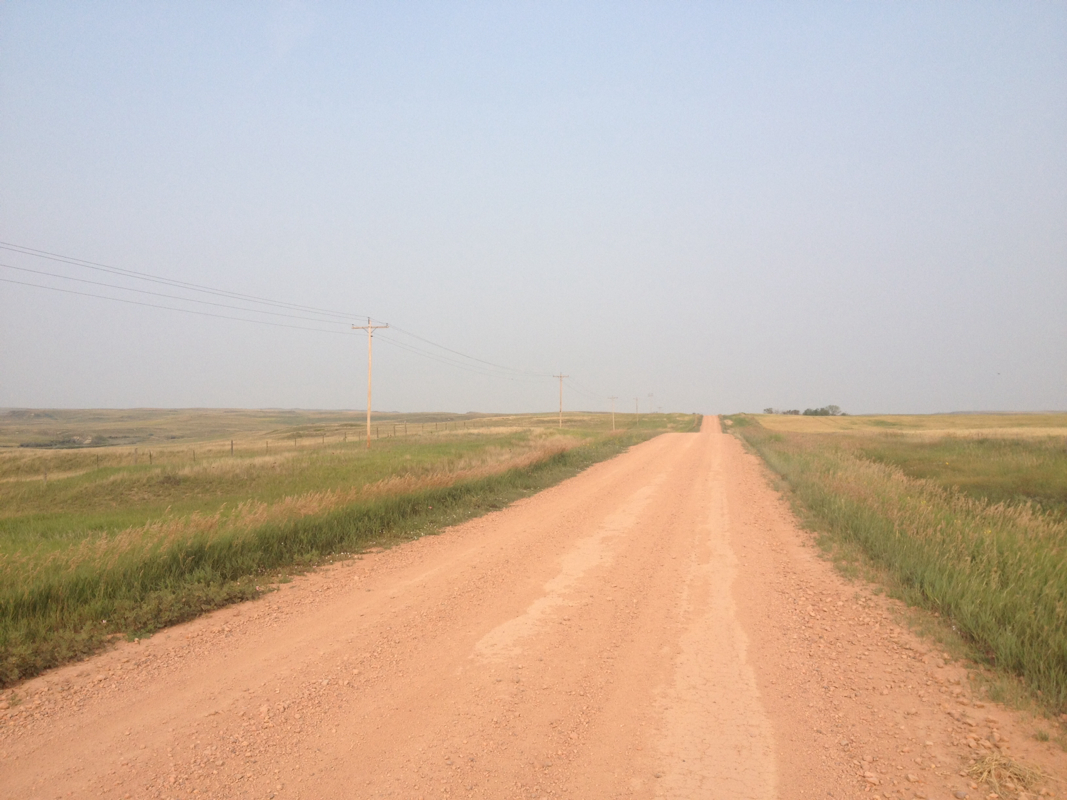
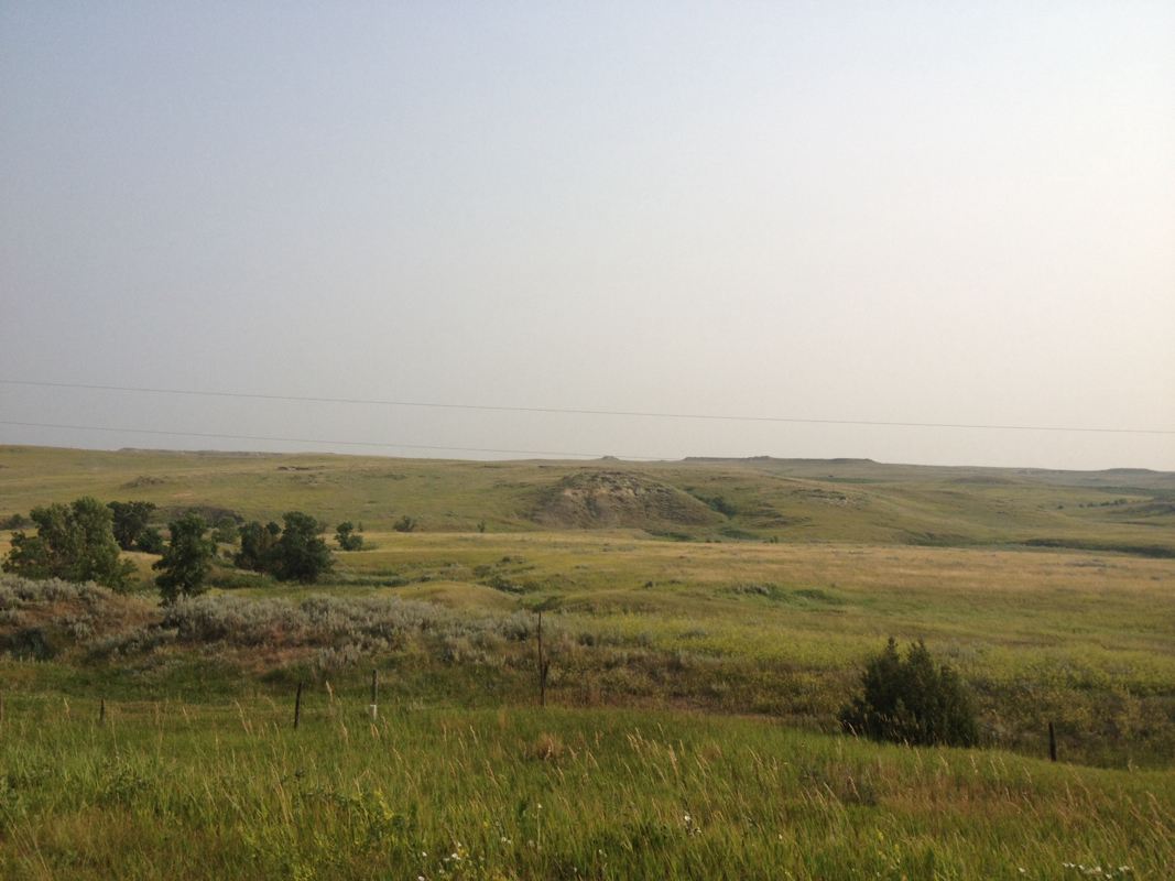
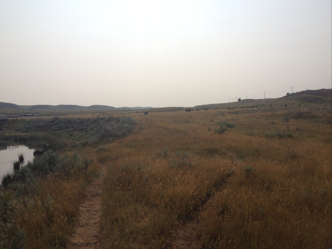
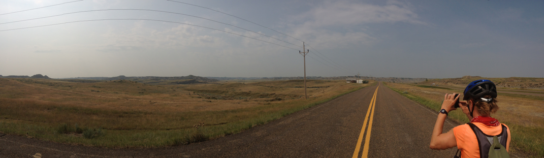
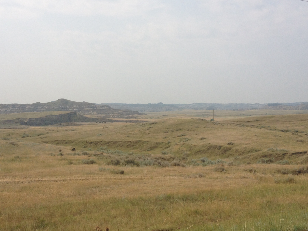
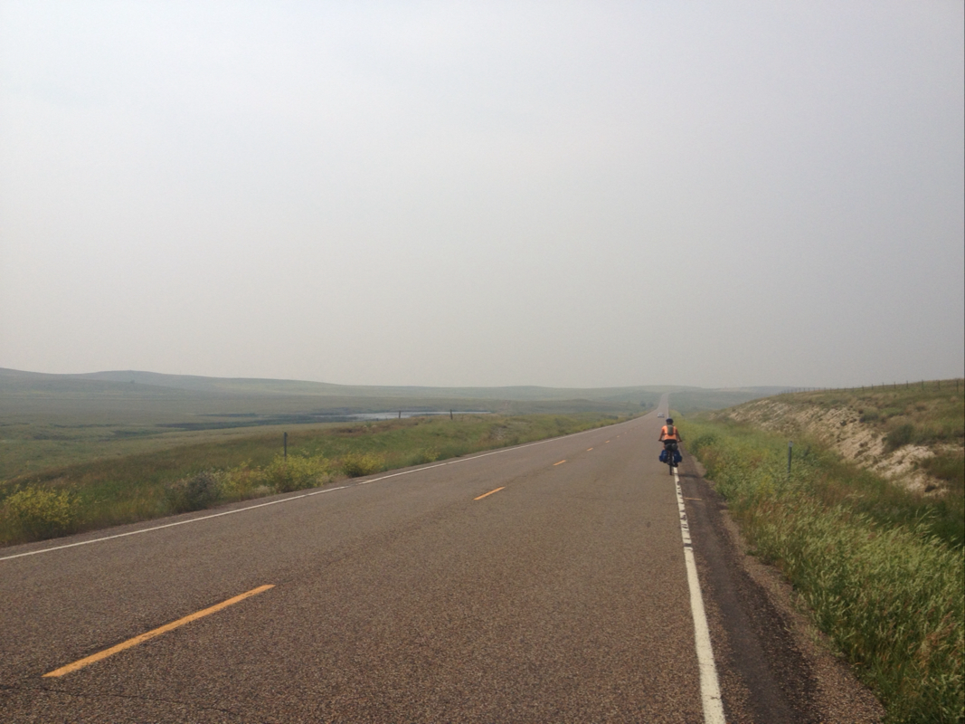
We began our morning in Wiboux.. The start of the ride out of the town was on gravel roads, seemingly our only options to get on the right track to reach Glendive and up to Circle (by bike at least!). This started out as Hodges Rd, passing the Wiboux high school and out of the town itself. Once outside of the few and far in between towns, the land as it has been throughout this part of the country is open, with few homes or buildings of any sort. There was farm field and ranch land, and far to the south side of the road, a train track. When a train passed in the distance, it looked to me like a miniature against the backdrop of hillscape and grassy outcrops. The wind was very calm, whichever way it was from. Gravel is rather slow going for us both -- slow for me on the uphills and slow for Laurel on the downhills. Actually, this has been something I have observed on any road. I am very slow climbing up, but love to fly down (though always keeping the speed manageable) and use the momentum to carry me up the next slope or as far as it will take me. Laurel is very strong and efficient climbing up, but goes quite slowly down and under careful control. So it was on our gravel roads for the morning. Mostly we moved fine over them, except for when large rocks had been laid which turned our tires every which way. From Hodges Rd we turned north onto Yates, which took us at last to the paved frontage road of I-94, called 106. This was a lovely down sloping road, plenty of pleasant hills down that pushed you up the smaller subsequent ups. I sped happily along. The frontage road was far separated from the interstate, sometimes by miles or by hill walls. 106 itself is a quiet narrow road through scenic Montana back country. Grassland and rock outcrops and buttes and tabletops and layered rocky hills all around, and stunning.
The only problem with this road is that we knew it would end at some point. Looking at google earth images, Laurel had determined that the road 106 would turn into 322, then would slowly turn to grass after perhaps 20 some miles from where we had first started outside if Wibaux, and then cease altogether at what appeared to be a creek. Then, about half a mile further up, and on the opposite side of the interstate, it would begin anew as frontage rd 300 which went into Glendive again along the interstate. Google did not suggest this route, but instead a hodgepodge of gravel roads. We decided nevertheless to try our luck with the paved frontage roads, despite the mystery of their disconnect and what we may contend with for that half mile. Grass? Fences? A creek? If nothing else, there appeared on map images to be a bridge of some sort for the interstate, so it was our hope that we might be able to go underneath to the other side.
After gliding happily along, I began to look out for signs of the end of the road. Sure enough, before me I saw that the paved road became increasingly grassy and overgrown, and the further we continued turned into gravel and grass and more vegetation until it was nothing at all and brought us to a barbed wire fence, leading down to a small stream with cattle hoof prints imprinted in the old mud. We had seen from a distance that there was also a truck and trailer parked here, and hoped maybe it was the landowner or rancher, who could help us somehow cross to the other side of the interstate or tell us about the road. There was no one there.
So, Laurel undid the wire gate, and we went into the cattle pasture. There were now cows here yet, but many deer flies that swarmed us. We peered down towards the stream and under the bridge. There was dry ground and cow path leading under the bridge beside the small stream. We walked with our bikes under the tunnel of the bridge, and emerging towards the otherwise was a cow and her calf no doubt perplexed to see us. We were now on the other side of the interstate, but still had to go some half mile west through shrubby and grassy pasture to reach what we hoped would be some form of frontage road, gravel or paved we would take whatever we might!
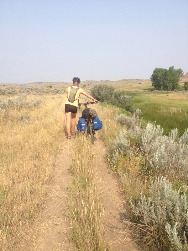
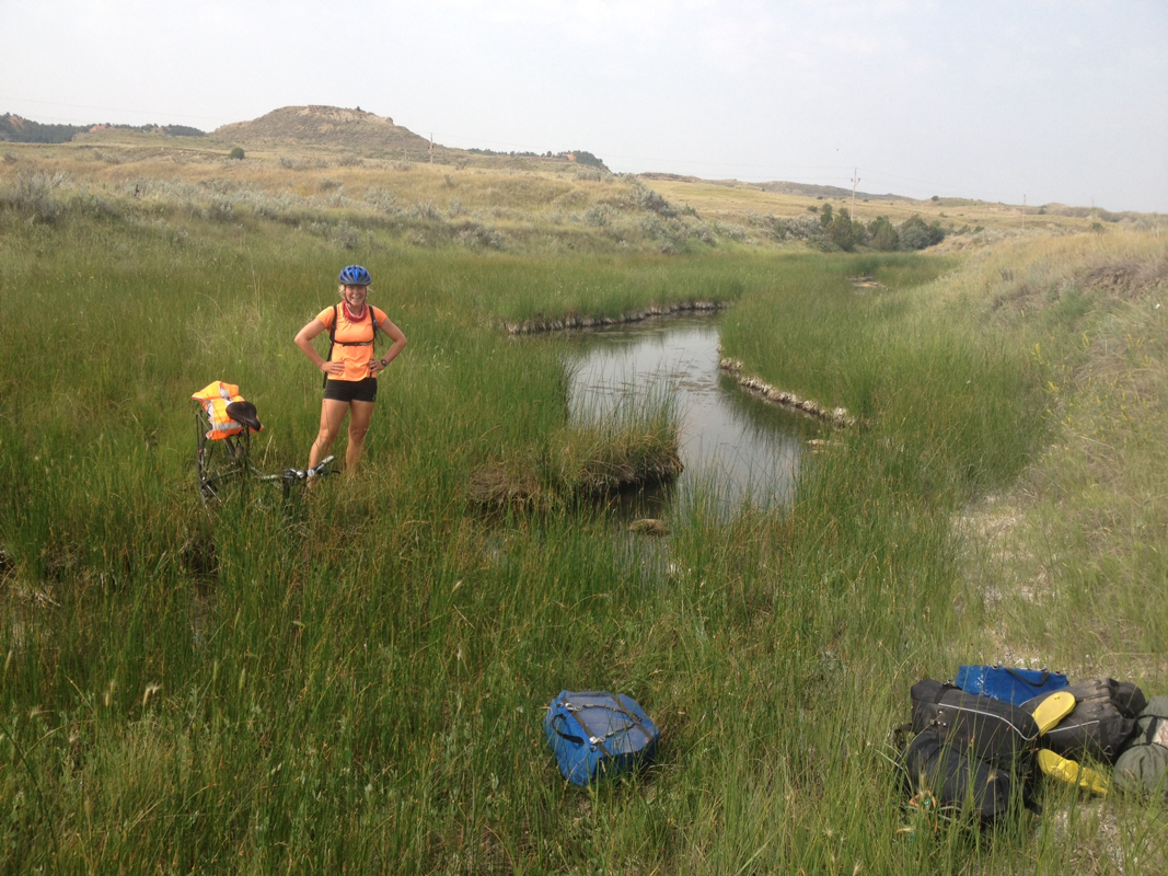
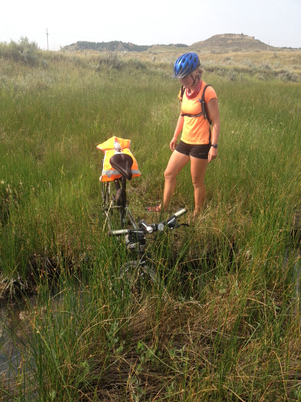
We followed the narrow cow paths farther out into the endless pasture. There were more cows and their calves, staring at us down the way, though we were headed away from them. We had hoped there would be someway to walk straight along the fence line, but there was a creek and slight hill side and wetland patch that curved out from there, and the cow path curved up and around. So we really were trekking through backcountry. It was not so easy to push our bikes down these uneven and disappearing cow trodden trails, through tall scratchy grass and sage scrub. Most of all, I think, we were apprehensive of rattle snakes. They are out here, and we have been warned of them in grass. Though snakes almost always sense someone coming and leave before they are seen, we felt we might be asking for trouble cutting across remote grassland pasture. Coming around one bend and looking up, there was another cow and her calf walking towards us. She stared at us still and wary, and we talked calmly to her to tell her we were coming. After staring, they turned around and ran the way they had come. But it was not cows I was nervous of. It was bulls. I knew, surely, there would be one out among the grass land someplace. And sure enough, as we climbed a bit more up the bend, I saw his broad, furrowed head near where the cow had run. He was not too close, but still too close! He watched us and we walked slowly onwards. Luckily, he was not interested. He was a young bull, though still large enough, and must have wondered at the commotion from the cow running back. From here we had come a bit up a hill and could see the interstate, and the cars and semis seemed rather small from where we were in the grass! There were no cow trails leading back towards the road so we trekked our own, through scrubbier sage and dirt and cowpies and grass. According to google maps and Laurels phone there should be a road parallel to the interstate of some sort, though slightly up the ridge of the land and so we could not see to be sure. When we came down the hill, there was still the drainage creek we had curved to avoid, and it still had water in it, significant enough to be rather wide and surely knee deep or deeper with mud and murky manure water. There were deep green sedges lining either bank, and so I knew the ground all around would be wet and sinking. Still, we did not wish to walk through the grassland all the way to the buildings far ahead, and wanted to get as directly back to road as we could. I went down into the vegetation along the banks to test the ground, standing in bent over dried grass and sedge and trying to keep an eye on the deep hoof prints of cattle who had sunken into wet patches. There was water beneath me, but it was sturdy enough to reach the stream itself. Once there, I followed along shortly and yes! There was a narrow spot, and a clump of mud in the middle where we might hop across. We wet back to get the bikes, took off our gear, brought it back down to the banks, and tossed it to the other bank. Then we went back up and got our bikes, and forded them across (mine went for a little swim) after I hopped over the water. Laurel then brought hers down and passed it across to me. Then Laurel herself with a hand from me jumped across the stream with the clump of mud that was our stepping stone. An off roads adventure indeed!! After doing so we climbed up the bit of ridge to see if there was any road at all. Ha! There were two old tracks in the dirt and grass and shrub that perhaps long ago had been some form of dirt road. But a road it was, even if it was still inside pasture. So we went back for our bikes and pushed them along. Ahead, there was another wire fence. But beyond it, a paved frontage road and a couple houses! After working open the wire gate, we were out! Phew. I read the sign on the post. It was state conservation land we had been in, and not private land after all. For the better, because I had worried that we may be called trespassing. But we had reached the continuation of our road, and we were proud of our mettle. Laurel said it had saved us 5 miles at least on gravel roads, though the time and effort we spent may have been more (but a better story anyways!).
Undoubtedly, to the man mowing his lawn down this seeming dead end of a road, we appeared out of absolutely nowhere. A puzzle that must have been to him!
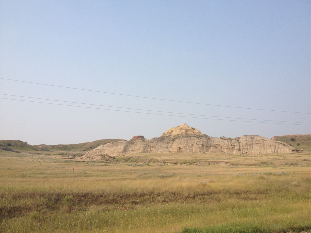
Rd 300 brought us the rest of the way to Glendive, through beautiful high up buttes and light orange stone and formations. In Glendive, a decently sized town and strongly influenced by growth of oil business we had heard, we ate lunch and patted ourselves on the backs once more for our off the beaten track morning.
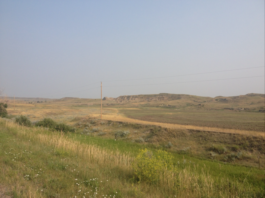
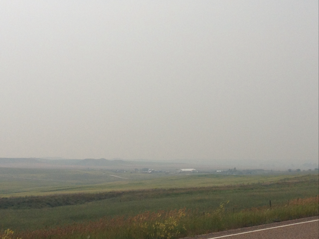
From Glendive we followed 200S west towards Circle. This was flattish at first, but the wind had picked up somewhat and the road was slow. I felt suddenly very tired, especially knowing that we still had 47 miles for the second half of the day to cover. I could not move very quickly. Also during this time, the sky to the west became gradually more grey and almost palely ashen. It seemed perhaps like light cloud cover, but as the air became dustier, we guessed it was actually from the fires out west in Washington. Though the light was dimmer now, we kept on sunglasses to protect our eyes from the grit in the air.
It was some 20 miles to the more or less none existent town of Lindsey. The wind was a bit against us, and the road still flattish but subtly climbing. During this stretch I began to feel the wear of fatigue, and in fact to grow very ill from it, and perhaps from the dry, ashy air. I think that, as I have grow increasingly tired, my body becomes very sick by the last third of the rides. The distances are undoubtedly too far for me, and I think I often become feverish and sickly trying to push through. I almost never get sick, and the achenes and fevery way I am getting after the 70 mile or so point into the 90 miles each day is certainly no wise way. Oh well. I could barely straggle in to the closed parking lot of an equipment dealer. Here I despaired, knowing 27 miles still awaited. And I wished very much to sit and recover for a bit, perhaps 20 minutes, but I guessed Laurel would not wish to wait. After drinking a bit (and secretly taking more pain medication) I rolled slowly onwards. I stopped again not more than 5 miles away, telling Laurel that now I truly did feel ill. She said we could wave down a car and then she would continue on. I blinked. Though she likely did not mean insult, I was affronted. When it is clear that a friend is falling apart and needs to sit down for a bit, that is not the offer to make. Why not suggest resting a moment? Though we both like to make good time, we are not in a rush such that we cannot take decent breaks when needed. And though locals here are undoubtedly good people, it can still be dangerous hitching a ride and so why would you send a friend alone? I am of the personality never to leave one behind, especially not a friend. I am someone who knows to wait and be patient and encouraging with those facing challenge, and in situations such as long trips. And I do not take another's fatigue lightly, particularly not on the road. Besides that, I knew that I could finish it, and merely needed a bit longer to actually recover than 5 minutes of standing over my bike. But oh well. We continued onwards and I asked Laurel to go in front of me so that I could not see the road, and put my head down. The skies became more dim and hazy, a very strange atmosphere as if a spell--and not a mesmerizing one as in the valley at Marmarth, but a sickly one--had spread about us. The air was hot, but light clouded. Behind it, the sun fought to shine and shimmered now and then at the edge of the pallid ash. There was blue sky behind it.
From here, the road began to climb slightly more, but then to begin a lengthy and gradual descent into a valley of sorts, climbing and then falling and then climbing slightly and then falling more. The hillscape to the west was hazy and silhouetted. We were up high, it seemed, and going down. This change of pace helped me, and also the strange atmosphere, which I found beautiful if slightly haunting, like the mounds of wrights or barrow downs. But the plants and rolling land were unaffected by the grey, and it did not seem disheartening but cheerful enough and open. There was definitely more descent than ascent, and this also helped to push me onwards. I was feeling stronger and my illness left behind now that we had entered this new scape.
About 3 miles from Circle, a Wisconsin license plate SUV pulled up near Laurel up ahead. They seemed to be talking to her. When I pulled up after, a man in a vacation shirt was giving Laurel some water. He had stopped, seeing us and having bikes before and wanted to help us out with a drink. Fortuitous indeed, because though we were near to our destination and in no danger, Laurel had just run out of water and was thirsty. What a kind fellow!!
We made it to Circle, not too much of a town though I hear there will be a rodeo this weekend. We got snacks at the gas station, where we learned that the only motel was the one we had just passed and which we had both cringed at. But oh well! Sitting outside the station on curb, drinking juice and milk and likely looking quite messy, there were many RVs and campers and cars pulling in for gas. Towns are far apart here! We nets that there were many from Wisconsin and Minnesota. A man and his wife from Minnesota, near to where our college St Olaf is located, came to speak with us. He was quite impressed that we've come up from Houston! He talked to us kindly for a while and we shared stories and some good laughs. As we were parting ways, a middle aged man on a bike pulled up. He was on a bike trip too! He had started near Portland and was headed to Boston. He is named Anton, age 65, originally from South Africa and wanted to see more of the United States. We were both super impressed by him, and by how far he has come, as well as his ambition. We both hope we can keep up his activity when we are his age! (Though as for me, I doubt if I will ever again do such long daily distances for so many days on end. 60 miles a day is fine for me, thank you very much, and not 90! And if Laurel didn't have a time limit for this trip I would insist upon it! It is far more pleasant).
When we went over to the motel to inquire about a room, there was an older woman who emerged from the office. At first she seemed stern, but actually hid a very kind smile and was very nice, though put out. This was, in part I guess, because of exasperation with the roads we had mentioned in these parts. She is a local, but says that she doesn't even go over east towards South Dakota anymore because of oil. Oil, she said, grimly. Oil. She said you take your life into your own hands with the roads east. Nostalgically, she said she used to go to Williston sometimes. But not anymore. Not since at least 4 years ago. Because of oil.
Some may say that the oil boom out here and in north Dakota has brought benefits for business, but all I seem to hear from locals is frustration. Frustration, and apprehension.
Tomorrow, we hope to make our way towards the Fort Peck area, and from there towards Glasgow, then up towards Morgan. We are getting close, and though I am excited, and though the distance seems small now, it may as well be another thousand miles at times. But each mile at a time. And will patience and diligence, I hope to make it all the way!
We began our morning in Wibaux. The start of the ride out of the town was on gravel roads, seemingly our only options to get on the right track to reach Glendive and up to Circle (by bike at least!). This started out as Hodges Rd, passing the Wibaux high school and out of the town itself. Once outside of the few and far in between towns, the land as it has been throughout this part of the country is open, with few homes or buildings of any sort. There was farm field and ranch land, and far to the south side of the road, a train track. When a train passed in the distance, it looked to me like a miniature against the backdrop of hillscape and grassy outcrops. The wind was very calm, whichever way it was from. Gravel is rather slow going for us both -- slow for me on the uphills and slow for Laurel on the downhills. Actually, this has been something I have observed on any road. I am very slow climbing up, but love to fly down (though always keeping the speed manageable) and use the momentum to carry me up the next slope or as far as it will take me. Laurel is very strong and efficient climbing up, but goes quite slowly down and under careful control. So it was on our gravel roads for the morning. Mostly we moved fine over them, except for when large rocks had been laid which turned our tires every which way. From Hodges Rd we turned north onto Yates, which took us at last to the paved frontage road of I-94, called 106. This was a lovely down sloping road, plenty of pleasant hills down that pushed you up the smaller subsequent ups. I sped happily along. The frontage road was far separated from the interstate, sometimes by miles or by hill walls. 106 itself is a quiet narrow road through scenic Montana back country. Grassland and rock outcrops and buttes and tabletops and layered rocky hills all around, and stunning.
The only problem with this road is that we knew it would end at some point. Looking at google earth images, Laurel had determined that the road 106 would turn into 322, then would slowly turn to grass after perhaps 20 some miles from where we had first started outside if Wibaux, and then cease altogether at what appeared to be a creek. Then, about half a mile further up, and on the opposite side of the interstate, it would begin anew as frontage rd 300 which went into Glendive again along the interstate. Google did not suggest this route, but instead a hodgepodge of gravel roads. We decided nevertheless to try our luck with the paved frontage roads, despite the mystery of their disconnect and what we may contend with for that half mile. Grass? Fences? A creek? If nothing else, there appeared on map images to be a bridge of some sort for the interstate, so it was our hope that we might be able to go underneath to the other side.
After gliding happily along, I began to look out for signs of the end of the road. Sure enough, before me I saw that the paved road became increasingly grassy and overgrown, and the further we continued turned into gravel and grass and more vegetation until it was nothing at all and brought us to a barbed wire fence, leading down to a small stream with cattle hoof prints imprinted in the old mud. We had seen from a distance that there was also a truck and trailer parked here, and hoped maybe it was the landowner or rancher, who could help us somehow cross to the other side of the interstate or tell us about the road. There was no one there.
So, Laurel undid the wire gate, and we went into the cattle pasture. There were now cows here yet, but many deer flies that swarmed us. We peered down towards the stream and under the bridge. There was dry ground and cow path leading under the bridge beside the small stream. We walked with our bikes under the tunnel of the bridge, and emerging towards the otherwise was a cow and her calf no doubt perplexed to see us. We were now on the other side of the interstate, but still had to go some half mile west through shrubby and grassy pasture to reach what we hoped would be some form of frontage road, gravel or paved we would take whatever we might!
We followed the narrow cow paths farther out into the endless pasture. There were more cows and their calves, staring at us down the way, though we were headed away from them. We had hoped there would be someway to walk straight along the fence line, but there was a creek and slight hill side and wetland patch that curved out from there, and the cow path curved up and around. So we really were trekking through backcountry. It was not so easy to push our bikes down these uneven and disappearing cow trodden trails, through tall scratchy grass and sage scrub. Most of all, I think, we were apprehensive of rattle snakes. They are out here, and we have been warned of them in grass. Though snakes almost always sense someone coming and leave before they are seen, we felt we might be asking for trouble cutting across remote grassland pasture. Coming around one bend and looking up, there was another cow and her calf walking towards us. She stared at us still and wary, and we talked calmly to her to tell her we were coming. After staring, they turned around and ran the way they had come. But it was not cows I was nervous of. It was bulls. I knew, surely, there would be one out among the grass land someplace. And sure enough, as we climbed a bit more up the bend, I saw his broad, furrowed head near where the cow had run. He was not too close, but still too close! He watched us and we walked slowly onwards. Luckily, he was not interested. He was a young bull, though still large enough, and must have wondered at the commotion from the cow running back. From here we had come a bit up a hill and could see the interstate, and the cars and semis seemed rather small from where we were in the grass! There were no cow trails leading back towards the road so we trekked our own, through scrubbier sage and dirt and cowpies and grass. According to google maps and Laurels phone there should be a road parallel to the interstate of some sort, though slightly up the ridge of the land and so we could not see to be sure. When we came down the hill, there was still the drainage creek we had curved to avoid, and it still had water in it, significant enough to be rather wide and surely knee deep or deeper with mud and murky manure water. There were deep green sedges lining either bank, and so I knew the ground all around would be wet and sinking. Still, we did not wish to walk through the grassland all the way to the buildings far ahead, and wanted to get as directly back to road as we could. I went down into the vegetation along the banks to test the ground, standing in bent over dried grass and sedge and trying to keep an eye on the deep hoof prints of cattle who had sunken into wet patches. There was water beneath me, but it was sturdy enough to reach the stream itself. Once there, I followed along shortly and yes! There was a narrow spot, and a clump of mud in the middle where we might hop across. We wet back to get the bikes, took off our gear, brought it back down to the banks, and tossed it to the other bank. Then we went back up and got our bikes, and forded them across (mine went for a little swim) after I hopped over the water. Laurel then brought hers down and passed it across to me. Then Laurel herself with a hand from me jumped across the stream with the clump of mud that was our stepping stone. An off roads adventure indeed!! After doing so we climbed up the bit of ridge to see if there was any road at all. Ha! There were two old tracks in the dirt and grass and shrub that perhaps long ago had been some form of dirt road. But a road it was, even if it was still inside pasture. So we went back for our bikes and pushed them along. Ahead, there was another wire fence. But beyond it, a paved frontage road and a couple houses! After working open the wire gate, we were out! Phew. I read the sign on the post. It was state conservation land we had been in, and not private land after all. For the better, because I had worried that we may be called trespassing. But we had reached the continuation of our road, and we were proud of our mettle. Laurel said it had saved us 5 miles at least on gravel roads, though the time and effort we spent may have been more (but a better story anyways!).
Undoubtedly, to the man mowing his lawn down this seeming dead end of a road, we appeared out of absolutely nowhere. A puzzle that must have been to him!
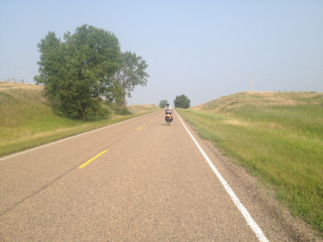
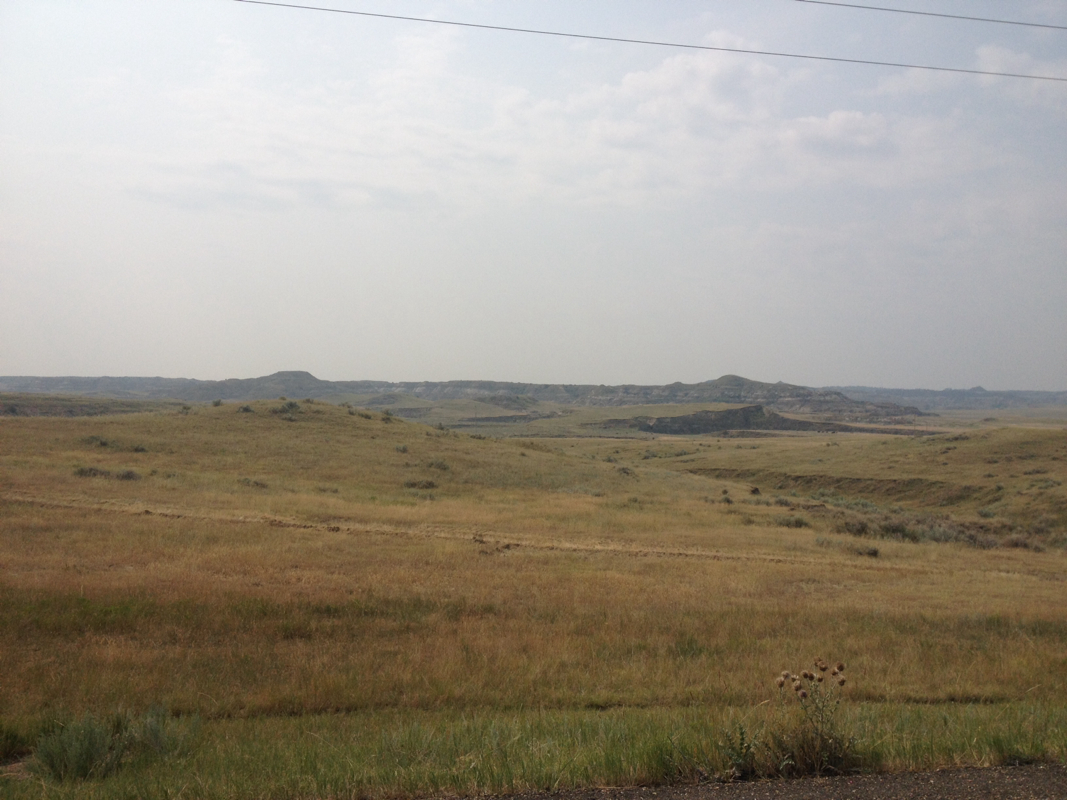
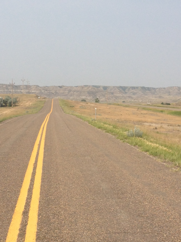
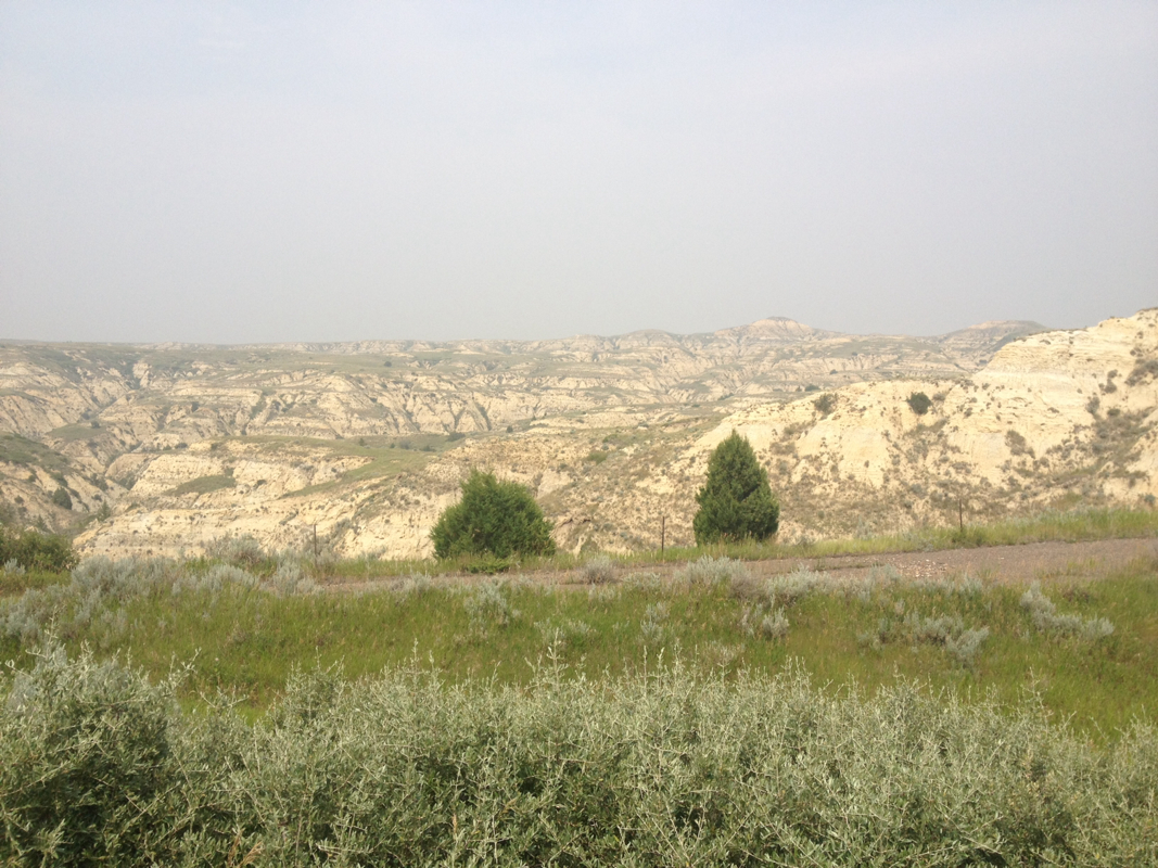
Rd 300 brought us the rest of the way to Glendive, through beautiful high up buttes and light orange stone and formations. In Glendive, a decently sized town and strongly influenced by growth of oil business we had heard, we ate lunch and patted ourselves on the backs once more for our off the beaten track morning.
From Glendive we followed 200S west towards Circle. This was flattish at first, but the wind had picked up somewhat and the road was slow. I felt suddenly very tired, especially knowing that we still had 47 miles for the second half of the day to cover. I could not move very quickly. Also during this time, the sky to the west became gradually more grey and almost palely ashen. It seemed perhaps like light cloud cover, but as the air became dustier, we guessed it was actually from the fires out west in Washington. Though the light was dimmer now, we kept on sunglasses to protect our eyes from the grit in the air.
It was some 20 miles to the more or less none existent town of Lindsey. The wind was a bit against us, and the road still flattish but subtly climbing. During this stretch I began to feel the wear of fatigue, and in fact to grow very ill from it, and perhaps from the dry, ashy air. I think that, as I have grow increasingly tired, my body becomes very sick by the last third of the rides. The distances are undoubtedly too far for me, and I think I often become feverish and sickly trying to push through. I almost never get sick, and the achenes and fevery way I am getting after the 70 mile or so point into the 90 miles each day is certainly no wise way. Oh well. I could barely straggle in to the closed parking lot of an equipment dealer. Here I despaired, knowing 27 miles still awaited. And I wished very much to sit and recover for a bit, perhaps 20 minutes, but I guessed Laurel would not wish to wait. After drinking a bit (and secretly taking more pain medication) I rolled slowly onwards. I stopped again not more than 5 miles away, telling Laurel that now I truly did feel ill. She said we could wave down a car and then she would continue on. I blinked. Though she likely did not mean insult, I was affronted. When it is clear that a friend is falling apart and needs to sit down for a bit, that is not the offer to make. Why not suggest resting a moment? Though we both like to make good time, we are not in a rush such that we cannot take decent breaks when needed. And though locals here are undoubtedly good people, it can still be dangerous hitching a ride and so why would you send a friend alone? I am of the personality never to leave one behind, especially not a friend. I am someone who knows to wait and be patient and encouraging with those facing challenge, and in situations such as long trips. And I do not take another's fatigue lightly, particularly not on the road. Besides that, I knew that I could finish it, and merely needed a bit longer to actually recover than 5 minutes of standing over my bike. But oh well. We continued onwards and I asked Laurel to go in front of me so that I could not see the road, and put my head down. The skies became more dim and hazy, a very strange atmosphere as if a spell--and not a mesmerizing one as in the valley at Marmarth, but a sickly one--had spread about us. The air was hot, but light clouded. Behind it, the sun fought to shine and shimmered now and then at the edge of the pallid ash. There was blue sky behind it.
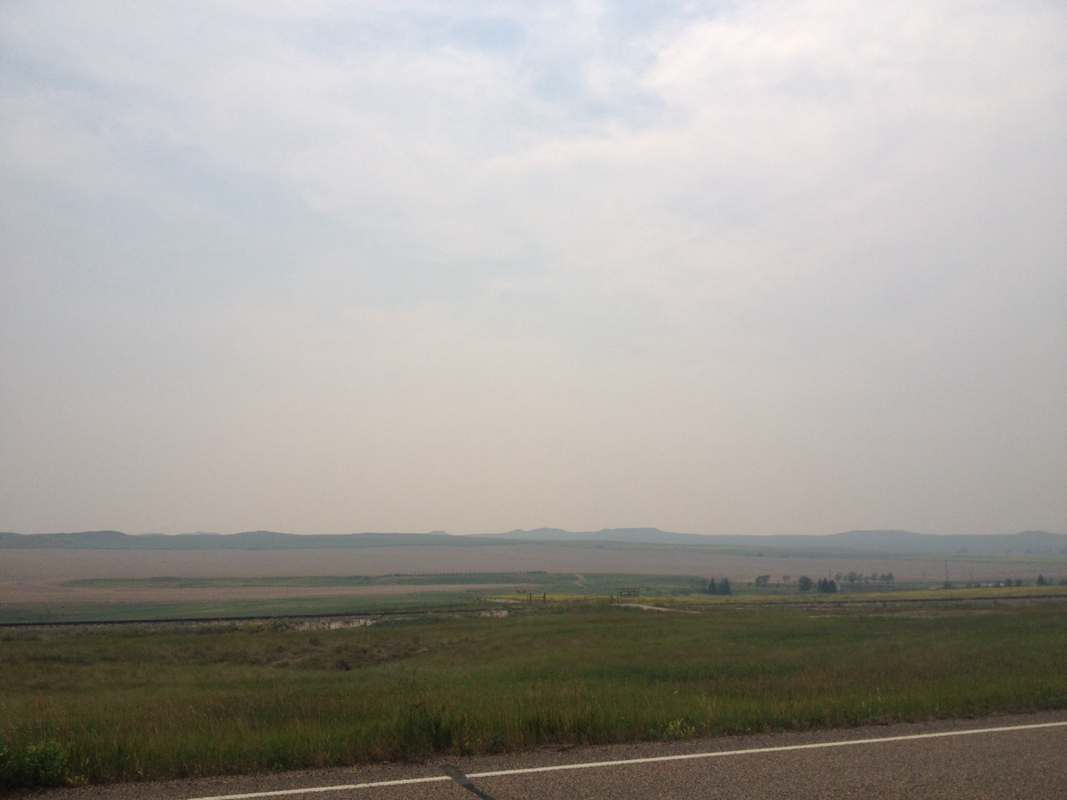
From here, the road began to climb slightly more, but then to begin a lengthy and gradual descent into a valley of sorts, climbing and then falling and then climbing slightly and then falling more. The hillscape to the west was hazy and silhouetted. We were up high, it seemed, and going down. This change of pace helped me, and also the strange atmosphere, which I found beautiful if slightly haunting, like the mounds of wrights or barrow downs. But the plants and rolling land were unaffected by the grey, and it did not seem disheartening but cheerful enough and open. There was definitely more descent than ascent, and this also helped to push me onwards. I was feeling stronger and my illness left behind now that we had entered this new scape.
About 3 miles from Circle, a Wisconsin license plate SUV pulled up near Laurel up ahead. They seemed to be talking to her. When I pulled up after, a man in a vacation shirt was giving Laurel some water. He had stopped, seeing us and having bikes before and wanted to help us out with a drink. Fortuitous indeed, because though we were near to our destination and in no danger, Laurel had just run out of water and was thirsty. What a kind fellow!!
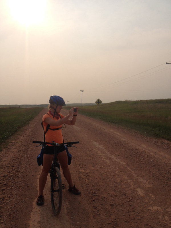
We made it to Circle, not too much of a town though I hear there will be a rodeo this weekend. We got snacks at the gas station, where we learned that the only motel was the one we had just passed and which we had both cringed at. But oh well! Sitting outside the station on curb, drinking juice and milk and likely looking quite messy, there were many RVs and campers and cars pulling in for gas. Towns are far apart here! We nets that there were many from Wisconsin and Minnesota. A man and his wife from Minnesota, near to where our college St Olaf is located, came to speak with us. He was quite impressed that we've come up from Houston! He talked to us kindly for a while and we shared stories and some good laughs. As we were parting ways, a middle aged man on a bike pulled up. He was on a bike trip too! He had started near Portland and was headed to Boston. He is named Anton, age 65, originally from South Africa and wanted to see more of the United States. We were both super impressed by him, and by how far he has come, as well as his ambition. We both hope we can keep up his activity when we are his age! (Though as for me, I doubt if I will ever again do such long daily distances for so many days on end. 60 miles a day is fine for me, thank you very much, and not 90! And if Laurel didn't have a time limit for this trip I would insist upon it! It is far more pleasant).
When we went over to the motel to inquire about a room, there was an older woman who emerged from the office. At first she seemed stern, but actually hid a very kind smile and was very nice, though put out. This was, in part I guess, because of exasperation with the roads we had mentioned in these parts. She is a local, but says that she doesn't even go over east towards South Dakota anymore because of oil. Oil, she said, grimly. Oil. She said you take your life into your own hands with the roads east. Nostalgically, she said she used to go to Williston sometimes. But not anymore. Not since at least 4 years ago. Because of oil.
Some may say that the oil boom out here and in north Dakota has brought benefits for business, but all I seem to hear from locals is frustration. Frustration, and apprehension.
Tomorrow, we hope to make our way towards the Fort Peck area, and from there towards Glasgow, then up towards Morgan. We are getting close, and though I am excited, and though the distance seems small now, it may as well be another thousand miles at times. But each mile at a time. And will patience and diligence, I hope to make it all the way!
 RSS Feed